2009
OpenStreetMap
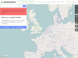
by 21 othersOpenStreetMap allows you to view, edit and use geographical data in a collaborative way from anywhere on Earth. Export PS, SVG, PNG...XML and embedding
2006
1
(2 marks)
Founded in late 2003 and heartquartered in France, we are non-profit and independant.
We believe in the open web, think internet services should be sustainable, build for the long term.
While we are re-launching the service, we only accept new members through invitation.
3d ![]() add-ons
add-ons ![]() aim
aim ![]() ajax
ajax ![]() api
api ![]() application
application ![]() article
article ![]() ascii
ascii ![]() bible
bible ![]() blogging
blogging ![]() bookmarks
bookmarks ![]() brain
brain ![]() buiding
buiding ![]() chart
chart ![]() chat
chat ![]() china
china ![]() click
click ![]() clock
clock ![]() collaborative
collaborative ![]() community
community ![]() converter
converter ![]() demographic
demographic ![]() download
download ![]() draw
draw ![]() ecard
ecard ![]() ecology
ecology ![]() editor
editor ![]() elearning
elearning ![]() engine
engine ![]() experiment
experiment ![]() extension
extension ![]() flash
flash ![]() flickr
flickr ![]() flu
flu ![]() fosto
fosto ![]() free
free ![]() game
game ![]() genealogy
genealogy ![]() generator
generator ![]() geo
geo ![]() geography
geography ![]() google
google ![]() gps
gps ![]() gtalk
gtalk ![]() history
history ![]() icq
icq ![]() information
information ![]() interactive
interactive ![]() interesting
interesting ![]() jabber
jabber ![]() japan
japan ![]() japanese
japanese ![]() java
java ![]() list
list ![]() live
live ![]() local
local ![]() login
login ![]() maker
maker ![]() manager
manager ![]() mashup
mashup ![]() mobile
mobile ![]() msn
msn ![]() multiuser
multiuser ![]() network
network ![]() online
online ![]() opensource
opensource ![]() pdf
pdf ![]() photo
photo ![]() photos
photos ![]() player
player ![]() polution
polution ![]() population
population ![]() portal
portal ![]() reference
reference ![]() religion
religion ![]() search
search ![]() server
server ![]() service
service ![]() sevice
sevice ![]() social
social ![]() software
software ![]() swiss
swiss ![]() sync
sync ![]() tags
tags ![]() timeline
timeline ![]() tools
tools ![]() travel
travel ![]() twitter
twitter ![]() us
us ![]() visual
visual ![]() visualization
visualization ![]() war
war ![]() weather
weather ![]() web2.0
web2.0 ![]() weblog
weblog ![]() webpage
webpage ![]() website
website ![]() wiki
wiki ![]() world
world ![]() yahoo
yahoo ![]()
Feedback: @blogmarks on Twitter Designed & supported by Upian © 2004-19 the blogmarks.net team
