2014
2013

2010
2008
Modest Maps
Modest Maps is a BSD-licensed display and interaction library for tile-based maps in Flash (ActionScript 2.0 and ActionScript 3.0) and Python.
Our intent is to provide a minimal, extensible, customizable, and free display library for discriminating designers and developers who want to use interactive maps in their own projects. Modest Maps provides a core set of features in a tight, clean package, with plenty of hooks for additional functionality.


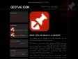
Home of the Geotag Icon Project
The Geotag Icon is intended as a web "standard" icon for identifying geotagged content to humans.
The advent of inexpensive GPS devices and free tools like Google Maps or Flickr Map mean that more and more people are associating their content (typically blog posts or photos) with a specific geographic location. Such "geotagging" stores coordinates within metadata or microformat tags—where machines can find them but people can't.
That's where the Geotag Icon comes in. It provides a visual reference to a map link, or if no link is yet made helps viewers recognize the geographic relevance of the content.
It's free, easy to use and helps us all visualize the developing semantic web.
2007
Google Maps PHP Class: Phoogle Maps | systemsevendesigns Freelance Web Development Cornelius, NC
Phoogle Maps (pronounced like Foogle Maps) is a PHP class that integrates itself with the Google Maps API and with the Google Geocoding API to make an easy to use interface to display Google Maps on your site. With about 5 lines of PHP code you can display a customized Google Map on your website. Please note that you will need a free Google Maps API Key to use Phoogle Maps

amCharts: customizable free flash charts
Ammap is an interactive flash map creation software. Use this tool to show locations of your offices, routes of your journeys, create your distributor map. Photos or illustrations can be used instead of maps, so you can make different presentations, e-le

GPS Visualizer
GPS Visualizer is a free, easy-to-use online utility that creates maps and profiles from GPS data (tracks and waypoints), street addresses, or simple coordinates.
2006


2005
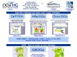
OOo.HG pour OpenOffice 2.0
ooo.hg alternative libre et gratuite pour créer en histoire géographie, cartes, croquis, fonds de carte, graphiques, chronologies, avec la gallery d'ooo
1
(21 marks)


