November 2008
Boundaries
(via)Paris délimité par les utilisateurs de Flickr. Forcément un peu différent de la réalité ;)

Avec vous, Eco89 tient à jour la carte de la crise sociale
(via)Eco89 va tenir à jour une carte des entreprises qui suppriment des emplois.
Category:SVG maps of France - Wikimedia Commons
Grand nombre de cartes de France au format SVG.

October 2008
Google Maps API Example: Reverse Geocoding
(via)Quand la latitude et la longitude deviennent compréhensibles par tous.
July 2008

April 2008

Functional Geography 2.0: France, the Ideal Household Utensil
"An handy household item".
March 2008

It's your world. Map it.
(via)Beyond editing existing information on the map, you can also add new places. ... It's your world... you know best what needs to be mapped.
Ça c'est en effet pas complètement sûr ;)
Geotag Icon Project
by 3 others (via)"The Geotag Icon is intended as a web "standard" icon for identifying geotagged content to humans."
Using Spreadsheet Mapper 2.0 with Google Earth & Google Maps
(via)"... a look at the Spreadsheet Mapper 2.0 tool created by the Outreach team for creating Google Earth and Google Maps placemark layers using Google Docs."
geohash.org is public!
(via)« geohash.org offers short URLs which encode a latitude/longitude pair, so that referencing them in emails, forums, and websites is more convenient. »
February 2008

January 2008

Nokia Beta Labs - Location Tagger
"Georeferencing your phone camera photos"
December 2007
jumptomap.com (Beta)
(via)« Friendly links to maps. » Exemple : http://jumptomaps.com/232-Rue-De-Rivoli--Paris---75001--France

Lancement officiel de Geoportail 3D
"... les cartes géographiques disponibles sur le Géoportail prennent du volume en adoptant la 3D."
October 2007

July 2007

Anagrammes de Métro
by 10 others (via)« ... carte du métro de Paris dans laquelle les noms de stations ont été remplacés par des anagrammes. »
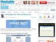
Online Maps : 50 Tools and Resources
by 1 other (via)« ... a list of the most interesting online mapping tools that some are referring to as “Maps 2.0″. »

June 2007
March 2007
February 2007
Return Latitude and Longitude Fast with Google Maps
by 1 other« Whenever you require a location coordinates on a google map click the bookmark and a prompt box displays the in latitude and longitude. »
3-D econ map
(via)Une visualisation 3D assez étonnante (notamment pour l'Europe ?!) de l'activité économique autour de la planète.