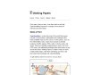
public marks

PUBLIC MARKS from philippej with tags maps & outils

June 2009

Walking Papers

by 1 other (via)
"Print maps, draw on them, scan them back in and help OpenStreetMap improve its coverage of local points of interests and street detail." Excellent et prometteur...

March 2008

geohash.org is public!

(via)
« geohash.org offers short URLs which encode a latitude/longitude pair, so that referencing them in emails, forums, and websites is more convenient. »

philippej's TAGS related to tag maps

3d +   api +   apllication +   bookmarklet +   carte +   cartographie +   data +   earth +   economie +   Environnement +   flickr +   geographie +   géographie +   google +   gps +   GPX +   graphiques +   histoire +   humour +   image +   information +   javascript +   kml +   metro +   microformats +   mobile +   mobilité +   navigation +   économie +   osm +   outils +   paris +   photo +   photos +   php +   politique +   pratique +   qrcode +   rss +   société +   sport +   statistiques +   svg +   tags +   tutoriels +   url +   video +   visualisation +   visualisations +   web +   weblogue +   wiki +