2010

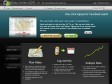
Gapminder.org
by 22 others"... explore the world by looking at complex data (statistics) in a highly visual way that is both understandable and compelling... "
Ride with GPS
(via)"... a recreational route sharing community for cyclists, motorcyclists, runners, hikers, mountain bikers, and anyone else who is involved in a route-oriented sport."
Un des nombreux outils en ligne permettant de tracer un parcours d'après une carte Google Maps. Petit + : l'élévation des tracés à l'air assez précise.
2009
Geomap ou comment mettre en oeuvre rapidement sur le web des cartes choroplètes ou en symboles (presque) proportionnels
(via)Tutoriel sur la création de cartes thématiques avec l'API Visualisation de Google [Rappel].
Cartographer.js
by 3 others (via)Première version d'une librairie javascript qui permet de créer des cartes thématiques avec Google Maps.

Google Street View Time Lapse on Flickr
(via)"... an idea for a website that automatically creates time lapse videos of drives through cities using images from the Street View feature of Google Maps. This is a rough example of what it might look like."
Bookmarklet pour passer de Google Maps à OpenStreetMap directement
by 1 other"Un petit bookmarklet pour passer de Google Maps à OpenStreetMap en un clic."
Paris - Google Maps - Transit
(via)Nouvelle visualisation des transits métro et rer dans google maps.
A voir aussi ratp.fr.
2008
mapof.it
by 3 others (via)Exemple d'application utilisant Tiny Geo-coder : "... a really simple way to get a map or a route without first visiting Google Maps... ". Pratique et rapide pour aller de Paris jusqu'à Nice.
Tiny Geo-coder
by 6 others (via)Un moyen en effet très rapide de retrouver la latitude et la longitude d'une localisation dans une application.
Google Maps API Example: Reverse Geocoding
(via)Quand la latitude et la longitude deviennent compréhensibles par tous.

It's your world. Map it.
(via)Beyond editing existing information on the map, you can also add new places. ... It's your world... you know best what needs to be mapped.
Ça c'est en effet pas complètement sûr ;)
Using Spreadsheet Mapper 2.0 with Google Earth & Google Maps
(via)"... a look at the Spreadsheet Mapper 2.0 tool created by the Outreach team for creating Google Earth and Google Maps placemark layers using Google Docs."
2007

Return Latitude and Longitude Fast with Google Maps
by 1 other« Whenever you require a location coordinates on a google map click the bookmark and a prompt box displays the in latitude and longitude. »
2006

KML on Google Maps
(via)« To view a KML or KMZ file on Maps, just go to Google Maps, and instead of searching for a geographical address like 1600 Amphitheatre Parkway, 94043, search for a complete Web address (including the "http://" part) of your KMZ file, like http://kml.lover.googlepages.com/cropcircles.kmz. »
Life of a Geolocated Blog Post
by 1 other (via)« View entire photo sets as self-contained KMZ files in Google Maps »
MapLib.net
by 1 other (via)« ... turn any image you uploaded as large as 6000*6000 into a custom Google Map in a really simple way. You can maintain markers for it, as well as embed it in your own web pages or blog. »
1
(21 marks)