June 2006
May 2006
April 2006
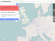

geosocial.net » GPS Visualizer
GPS Visualizer is a free, easy-to-use online utility that creates maps and profiles from GPS data
March 2006
February 2006
WW2D (like Google Earth)
WW2D is cross-platform, free and open-source application similar to NASA World Wind or Google Earth software. It allows you to explore Earth using satellite imagery, topographic maps and images from other data sources also providing large placenames and boundaries database and allowing you to install community-made add-ons for even more information about our planet.
January 2006

phone tracking system by world-tracker
presently only in UK , this service will (with consent of the phone user via txtmsg) allow you to track a phone's location without any new hardware
December 2005

Le Petit Poucet GPS software
Le Petit Poucet is free software to display and edit GPS routes and tracks in a 3D scene


JDMCOX Software
USAPhotoMaps downloads USGS aerial photo and topo map data from Microsoft's free TerraServer Web site, saves it on your hard drive, and creates maps with GPS accuracy.
November 2005
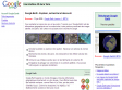
GPS Visualizer
Ce site permet de dessiner une carte, de dessiner un profil, de convertir un fichier provenant de plusieurs sources, de géolocaliser un point, de convertir différents types de coordonnées.