2016

Styling Wizard: Google Maps APIs
Customize colors, roads, labels, and more. Then use your custom style in your Google Maps APIs project.
2015
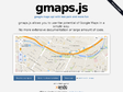
gmaps.js — Google Maps API with less pain and more fun
by 2 othersgmaps.js allows you to use the potential of Google Maps in a simple way.
No more extensive documentation or large amount of code.
2014
GMap Image Cutter
Includes a template to use the Image Cutter with Google Maps API v3 and fixes a bug with the maximum zoom level in version 1.41.
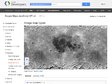
Create Zoomable Images Using The Google Maps API | Mike Gleason jr's Blog
by 1 otherAnyways, I'm pleased to show you two samples today: they both let you navigate into an image using the Google Maps engine. I'm also giving up the necessary tools to do it yourself. Enjoy!
1
(5 marks)
