August 2011

They rule
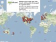
They Rule aims to provide a glimpse of some of the relationships of the US ruling class. It takes as its focus the boards of some of the most powerful U.S. companies, which share many of the same directors. Some individuals sit on 5, 6 or 7 of the top 1000 companies. It allows users to browse through these interlocking directories and run searches on the boards and companies. A user can save a map of connections complete with their annotations and email links to these maps to others. They Rule is a starting point for research about these powerful individuals and corporations.
July 2011


June 2011


May 2011
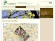
DC Street Tree Map › Interactive Maps & Tools › Geographic Resources | Casey Trees
These data were collected by UFA (Urban Forestry Administration) as they planted and maintained street trees in Washington DC. The tree data as well as LiDAR elevational information were downloaded from DCGIS OCTO and then joined together to produce this dataset. The street tree data were last updated in September 2010, and the LiDAR in 2009.
April 2011

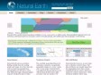
Natural Earth
Natural Earth is a public domain map dataset available at 1:10m, 1:50m, and 1:110 million scales. Featuring tightly integrated vector and raster data, with Natural Earth you can make a variety of visually pleasing, well-crafted maps with cartography or GIS software.

March 2011

Pour connaitre les sujets Twitter les plus tendances
Trendsmap est une carte interactive qui vous permet de connaitre les sujets les plus traités sur Twitter, le tout en temps réel. Une initiative intéressante pour être à la page ;-)

isokron
Where can the subway drive you to in 15 minutes ? Isokron gives you the answer in a graphical nifty way.

January 2011

Google Maps API Tutorial
A serie of tutorials and demo with Google Maps. Rather helpy when searching how to implement a functionnality.
December 2010

CloudMade Makes Maps Differently
Géolocalisation, des cartes comme google maps mais Open source !