November 2007
Outline Maps
These maps may be printed and copied for personal or classroom use.To request permission for other purposes please contact the Rights and Permissions Department.
PDF format but may be opened in Photoshop Elements as an image for coloring and labeling.
October 2007
Exploratree - Exploratree by FutureLab
Exploratree is a free web resource where you can download, use and make your own interactive thinking guides. Thinking guides can support independent and group research projects with frameworks for thinking, planning and enquiry. We’ve provided a set of ready-made guides which you can print out or use online. All of the guides are completely customizable or you can start from scratch and make your own! You can share them and work on them in groups too.
With Exploratree you can:
Use our ready-made thinking guides
Make a new thinking guide from scratch
Use it to set class projects
Print them out (they can go as big as A0)
Change and customise thinking guides, you can add or change text, shapes, images etc.
As a teacher, you can set up the sequence that you want the thinking guide to be revealed, so that you can stage the thinking activity
You can fill in a thinking guide and complete your project on the website
You can present your project
You can send your thinking guide to a whole group of people
You can submit a thinking guide for comments, so it can't be edited but just reviewed
Work in groups on the same thinking guide
September 2007
Teacher Resources - Collection - Panoramic Maps, 1847-1929
Ideas for using the Panoramic Maps collection from the Library of Congress Panorama Map Collection. Ideas for US History, Critical Thinking, and Arts & Humanities.
March 2007
Wayki: Show People Where!
Quick way for students to create map markers with photos and descriptions then share via a link. No signup required.
February 2007
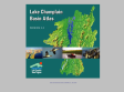
Lake Champlain Basin Atlas
The Lake Champlain Basin Atlas by the Lake Champlain Basin Program contains more than 40 full-color maps about the Lake Champlain Basin, articles about the maps, photographs, and a glossary. Extra resources, such as website links, manuals, and factsheets are also available. This 2004 version is loaded with lots of new information, many revised maps, and a new Students and Educators page!
January 2007
World66 - Your travel maps
My World66 is a service where you can create a map of the places you have visited. Choose countries of the world, states, Candadian provinces, or European Countries. Generate the html to place in webpage or right click to copy or save image. Easy to use...no signup.
1
(6 marks)