2010
Snaptrip on Flickr - Application Sharing!
snaptrip is a utility for better connecting Dopplr's past trips and your Flickr photos and sets.
2006
worldinpictures.org____Flickr geotagging application
by 1 otherallows you to view photos taken at any worldwide location. When you enter a location above, this is converted into a latitude/longitude pair which is used to look up "geotagged" photos on the photo sharing site Flickr. If you want your own pictures to app
Flickr Photo Compass 0.8 - 6V8 - a simple tool to browse photos of some place. By clicking on the direction icons, you can move around and find other photos.
is a simpler version of the radar that displays the 8 closest photos to the actual one in the directions : N, NE, E, SE, S, SW, W, NW.
BlockRocker > GeoTag Your Photos ____Flickr API Services (-)
GeoTag Your Photos You need to sign into Flickr and give BlockRocker.com permission to add Tags to your photos.
Flickr: loc.alize.us - All Our Flickr Photos on Google Maps! - GeoTagging Flickr (-)
loc.alize.us - All Our Flickr Photos on Google Maps! view profile aemkei Pro User [ FS FI INT ] says: After the great feedback on the Localize Bookmarklet I got the next secret something for you guys: A tool to browse the world of Flickr photos! Here you
loc.alize.us – Explore your world through everyone's eyes ___Bookmarklet Flickr extention
by 1 otherA smart way to browse and locate Flickr images on large map of the world. Filter photos by selecting a specific tag or searching for your buddy's user name. All navigation is done without any page refresh. An app that may save your boring afternoons. pro
Geotag your Flickr photos with the Localize bookmarklet
lickrStorm searches and collects Flickr images flickrstorm.png flickrstorm.png FlickrStorm is a third-party Flickr search tool that aims to give you new ways to search and collect photographs from Flickr. For example, searching for "coffee" will a
Flyr Pool 0.3 - insert a google map_6V8 - Production of my Mind____Flickr
Here is a Greasemonkey script to insert a google map _ (generated by Flyr) directly on the Flickr pages with multiple photos that contains geotags.
flickr map based browser on Flickr -
flickr map based browse
Visited Countries
by 13 othersVisited Countries Visited Countries is a small project demonstrating the power of manipulating the palette of a gif image on the fly. Here we start with a map of the world with each country in a different color. The script asks which country you have been
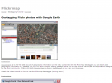
Geotagging Flickr photos with Google Earth
by 2 othersor those interested in geotagging via Google Earth I've writen a web app to do this.

MAKE: Blog: HOW TO GPS Tag Photos: Flickr, Mappr, Google Earth....
by 12 othersHOW TO GPS Tag Photos: Flickr, Mappr, Google Earth....
2005
Userscripts.org: Google Maps in Flickr
There's an easy way to see your geotagged photos on Gmap without leaving flickr. Just install the greasemonkey script to your firefox and see your photos shown on map right away. There will be a button added at the right-most of button bar if the photo is
GMiF - (Google Maps in Flickr)_+_del.icio.us Flickr Contacts_+_LfVr -(a Lightweight flickr )ViewerYuan.CC Web Experiments
by 7 othersThere's an easy way to see your geotagged photos on Gmap without leaving flickr. Just install the greasemonkey script to your firefox and see your photos shown on map right away. There will be a button added at the right-most of button bar if the photo is

Ted's Mozilla page - Google Maps Live
by 1 otherAllows you to feed latitude/longitude data to Google Maps and have it tracked in realtime
Geotagging Flickr with Google Maps and Greasemonkey Part 2
by 11 othersne fonctionne que pour USA et Irlande
1
(22 marks)
