2015

Mapzen · an open-source mapping lab.
by 1 other (via)Mapzen builds open-source mapping tools and collaborates on open geodata initiatives.
2014

Melbourne Remote Control Tourist
For five days in October the world got to explore
Melbourne like never before – controlling our tourists online in real time. Live and unscripted, as it happened
2013

Baidu Maps
Baidu Maps ou Beidu Maps est un service de cartographie en ligne chinois qui vise à concurrencer Google Maps en utilisant les futures images et relevés GPS du programme Beidou.
La cartographie de la Chine avait en 2011 un rendu visuel original, utilisant des dessins rappelant le jeu vidéo SimCity, à la place des images satellites classiques1

WhatWasThere - Put history in its place!
by 1 otherThe WhatWasThere project was inspired by the realization that we could leverage technology and the connections it facilitates to provide a new human experience of time and space – a virtual time machine of sorts that allows users to navigate familiar streets as they appeared in the past.

MapsTD
Tower Defense sur Google Maps

SRF Dok - Seidenstrasse Webdok
by 2 othersSeidenstrasse is the german name for the legendary commercial route «Silk Road». It is a google maps-based interactive web documentary about the different countries and its people.


2012

Google Maps API - More Than A Map
by 1 otherThe Google Maps API is more than a map for your apps. Explore demos of unique features that you can use in your apps today!


2013 Elantra | Driveway Decision Maker | Hyundai
Rentre ton adresse, et la voiture se gare près de chez toi.
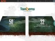
Tandems
Avec ARTE, élisez le jumelage emblème de l’amitié franco-allemande !

MapBox | Fast and beautiful maps
by 6 othersAn open mapping platform
MapBox helps you design beautiful maps and publish them across the web and mobile devices at scale. Our open source tools and cloud infrastructure are the base of a new kind of platform, making maps more social.

Explore | London Calling
Basé sur Google Map, ledit site propose une visite interactive de la ville où chaque quartier, chaque monument est systématiquement illustré de photographies et de légendes explicatives mais aussi une série d’animation consistants à répondre à diverses questions en remplaçant justement les lieux.

Solve 50 problems in 50 days
I'm on an adventure - to explore the limits of design's ability to solve social problems, big and small. To do this I attempted to solve 50 problems in 50 days using design. I also spent time with 12 of Europe's top design firms.

Nature Valley Trail View
As the Colorado River flows across the Colorado Plateau high country into northern Arizona, the serpentine bends of the channel carve a 277-mile canyon that is more than a mile deep, and, at its widest point, 18 miles across. Established as a national park by President Woodrow Wilson in 1919, Grand Canyon remains one of the most popular parks in America and has been named one of the Seven Natural Wonders of the World.
2011


Stories Unbound
'Stories Unbound' is the world's first social-media platform for writing and reading stories, brought to you in conjunction with those nice peeps at Melbourne Writers Festival.
Our free app lets you read, write and geotag stories. You can write stories about whatever you like, whenever youlike and wherever you like and then get them instantly published to our unique, 'Stories Unbound' Map, facebook and twitter.
2010

Historypin
by 1 otherHistorypin is a like a digital time machine that allows people to view and share their personal history in a totally new way.
It uses Google Maps and Street View technology and hopes to become the largest user-generated archive of the world's historical images and stories.
Historypin asks the public to dig out, upload and pin their own old photos, as well as the stories behind them, onto the Historypin map. Uniquely, Historypin lets you layer old images onto modern Street View scenes, giving a series of peaks into the past.

2009

Ground Zero: Google Maps and Nuclear Weapons
This mapplet shows the thermal damage caused by a nuclear explosion.
Search for a place, pick a suitable weapon and press "Nuke It!"
1
(23 marks)
