10 November 2007 09:15
Google Ocean : marine data for Google Maps / Google Earth
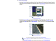
(via)Données maritimes visualisables dans GoogleEarth :
- Cables sous-marins, epaves, photos du littoral, cartes raster, etc
1
(1 marks)
Founded in late 2003 and heartquartered in France, we are non-profit and independant.
We believe in the open web, think internet services should be sustainable, build for the long term.
While we are re-launching the service, we only accept new members through invitation.
![]()
ajax ![]() blog
blog ![]() bretagne
bretagne ![]() collaboratif
collaboratif ![]() communauté
communauté ![]() Environnement
Environnement ![]() france
france ![]() georss
georss ![]() gis
gis ![]() gmt
gmt ![]() générateur
générateur ![]() google
google ![]() google maps
google maps ![]() gps
gps ![]() gshhs
gshhs ![]() infosthetics
infosthetics ![]() linux
linux ![]() logiciels libres
logiciels libres ![]() maritime
maritime ![]() mashup
mashup ![]() mer
mer ![]() microformat
microformat ![]() mysql
mysql ![]() ocean
ocean ![]() ogc
ogc ![]() opengis
opengis ![]() oracle
oracle ![]() paris
paris ![]() postgresql
postgresql ![]() rue
rue ![]() sport
sport ![]() syndication
syndication ![]() timeline
timeline ![]() transports
transports ![]() velib
velib ![]() velo
velo ![]() web
web ![]()
Feedback: @blogmarks on Twitter Designed & supported by Upian © 2004-19 the blogmarks.net team