August 2006

3D Links - Landscape and Terrian Editor
Contains a lot of links for different terrain editor
July 2006
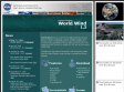
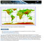
NASA World Wind
World Wind lets you zoom from satellite altitude into any place on Earth. Leveraging Landsat satellite imagery and Shuttle Radar Topography Mission data, World Wind lets you experience Earth terrain in visually rich 3D, just as if you were really there.
September 2005

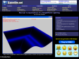
Article about Normal Computation for Heightfield Lighting on GameDev.net
Normal Computation for Heightfield Lighting

Terrain Visualization anf Flyby Animation
Contains software 3DEM that can convert many terrain data file to grey scale map
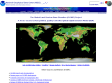
National Geophysical Data Center (NGDC)
NGDC contains DEM terrain data for the whole earth and allow people to download