2010
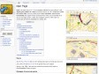
2009

2008
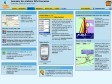

AlerteGPS.com - Avertisseur de radars AlerteGPS G100
Profitez de la meilleure base de données européenne du moment ! Une communauté de plus de 700.000 utilisateurs vous assurant une fiabilité des bases de données.
les radars fixes
les zones de contrôles mobiles
les zones dangereuses
La version Basic est mise à jour une fois par mois.
Le téléchargement des fichiers radars pour GPS sont entierement gratuit.
Vous devez créer gratuitement un compte pour accèder aux pages de téléchargement.

2007
2005
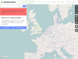
GPS Visualizer
Ce site permet de dessiner une carte, de dessiner un profil, de convertir un fichier provenant de plusieurs sources, de géolocaliser un point, de convertir différents types de coordonnées.
1
(8 marks)
