December 2006

Map and GIS News Blog for UK, Europe and World
Map and GIS finding blog... for UK, Europe and Worldwide Maps
Using GIS data intelligence on the web with Scalable Vector Graphics (SVG)
web mapping, location based services, wms, svgx, data editing, svgmapmaker, maps
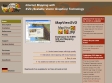
MapViewSVG Web Mapping-Examples
MapViewSVG is an extension for ArcGIS 8.x/9.x or ArcView GIS 3.x by ESRI. It gives you the opportunity to convert maps from ArcView GIS / ArcGIS into the SVG (Scalable Vector Graphics) format. You can then use these SVG files to publish them on the Web (Web Mapping) or on CD-ROM.

GIS for History
This site gives history students and teachers the power of GIS to investigate critical moments in American history (for example, here's our Great Migration map). Each investigation provides an interactive GIS map for studying patterns in historical census data over a period of time, a collection of historical documents chosen to help put the data into historical context, and lesson plans created by teachers and university instructors. We hope that this site makes American history more accessible to history students of all ages. Please explore!


November 2006


October 2006


GIS for History
This site gives history students and teachers the power of GIS to investigate critical moments in American history (for example, here's our Great Migration map). Each investigation provides an interactive GIS map for studying patterns in historical census data over a period of time, a collection of historical documents chosen to help put the data into historical context, and lesson plans created by teachers and university instructors. We hope that this site makes American history more accessible to history students of all ages. Please explore!