February 2010
A List Apart: Articles: Take Control of Your Maps
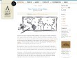
We live in the era of Google Maps. What started off as an impressive refresh of Mapquest-style maps now fuels web mashups. With APIs official and unofficial, Google Maps is simple enough for front-end designers to embed and for back-end programmers to target. Along the way to becoming nearly ubiquitous, it has played a major role in the “democratization of mapping.” For the practical developer who wants to add geospatial information to a site or application, the Google Maps API has been an easy call.


Poly9 Globe
Poly9 Globe is a cross-browser, cross-platform 3D globe which does not require any download. Give it a spin!
January 2010

TuxMobil: Linux Applications for GPS Navigation & Geographic Maps
This is a survey of Linux applications (almost all of them are Free Software) for navigation with laptops, notebooks, handhelds, PDAs and mobile phones. They are useful for bikers, car drivers, ship and air plane navigators and others. Additionally there are map conversion tools and links to freely available maps for GPS devices.
GPSd — Put your GPS on the net!
gpsd is a service daemon that monitors one or more GPSes or AIS receivers attached to a host computer through serial or USB ports, making all data on the location/course/velocity of the sensors available to be queried on TCP port 2947 of the host computer. With gpsd, multiple location-aware client applications (such as navigational and wardriving software) can share access to receivers without contention or loss of data. Also, gpsd responds to queries with a format that is substantially easier to parse than the NMEA 0183 emitted by most GPSes. The gpsd distribution includes a linkable C service library, a C wrapper class, and a Python module that developers of gpsd-aware applications can use to encapsulate all communication with gpsd.
December 2009
November 2009
Flickr: Landing Around The World
Documenting the approach into airports around the world. Let's see if we can get them all covered! Flickr recognises airport codes. If you add a video to your own map, then add the video to the group, it will show up on the group map auto-magically. Also, there's separate privacy level for location info on your photos. (You might be happy to let everyone see a photo, but only let your friends know where it was taken.)
October 2009
September 2009

Geolocater: géolocalisez-vous où vous le désirez! - ReLucBlog - SIG, MOZILLA & NTIC
Mais surtout puisque la géolocalisation devient un contexte de navigation pourquoi ne pas pouvoir la choisir facilement ? Geolocater vous permet de spécifier votre géolocalisation par défaut.
August 2009

July 2009

CloudMade Makes Maps Differently
CloudMade helps you make the most of map data. We source our maps from OpenStreetMap, the community mapping project which is making a free map of the world. Our aim is to continue the democratization of geo data and to expand access to open geo data through a range of simple yet powerful tools and APIs.
Our tools and APIs allow developers to create rich interactive experiences on the web and mobile.
June 2009


May 2009


April 2009

