2013

Google takes Street View off-road with backpack rig | Internet & Media - CNET News
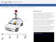
At its "Next Dimension" Google Maps event, the company shows off a backpack rig for mapping places inaccessible to vehicles. Also: 1 billion users access Google Earth each month.

'DIY streetview' camera lets you be Google | Crave - CNET
As Google takes Street View off-road with its new Trekker backpacks, German company Streetview Technology is taking the mapping technology in yet another new direction -- DIY terrain.
Cars, Trikes, and More – Street View – Google Maps
(via)When we first started Street View as an experimental project, we packed several computers into the back of an SUV, stuck cameras, lasers, and a GPS device on top, and drove around collecting our first imagery. Since Street View launched for five U.S. cities in May 2007, we've expanded our 360-degree panoramic views to include locations on all seven continents.
We then moved to a van for a brief period, before switching to a fleet of cars that would allow us to scale the project throughout the US and around the world. We went from a rack of computers to one small computer per car, and then set to work refining our camera system to capture higher-resolution panoramic views.
After several iterations of the car and camera technology, the latest car has 15 lenses taking 360 degrees of photos. It also has motion sensors to track its position, a hard drive to store data, a small computer running the system, and lasers to capture 3D data to determine distances within the Street View imagery.

Breadpig Shop - Buy Geeky Things & Make the World Suck Less! — Balloon Mapping Kit
Once assembled, this kit -- developed by community researchers from the Public Laboratory for Open Technology and Science -- enables you to collect your own aerial photos from up to 1000 ft. Using the open source MapKnitter web-based software, you can stitch the resulting images into a web-viewable map -- your own "counter-cartography" Google Maps. Use it to tell a different story from the "official" map -- document contamination (it was used to map the BP oil spill) or wetlands loss, or to record a temporary condition like the Occupy Oakland encampment.
2012

Street View and Beyond: Google’s Influence on Photography - LightBox
When Google Street View started as an experiment in 2007, the company sent SUVs equipped with cameras, GPS and lasers to collect its first pictures. The idea of capturing images of the entire world from the perspective of the street was revolutionary, if not a little insane. Now, five years later, Google has recorded 360-degree photographs of streets in more than 3,000 cities in 43 countries around the world. Google Street View cars—along with snowmobiles and giant tricycles–have covered more than five million unique miles of road since the project began, making tens of millions of still images in even the most far off places on the map, such as Antarctica.
2011
Jon Rafman
by 7 othersOne year ago, I started collecting screen captures of Google Street Views from a range of Street View blogs and through my own hunting. This essay illustrates how my Street View collections reflect the excitement of exploring this new, virtual world. The world captured by Google appears to be more truthful and more transparent because of the weight accorded to external reality, the perception of a neutral, unbiased recording, and even the vastness of the project. At the same time, I acknowledge that this way of photographing creates a cultural text like any other, a structured and structuring space whose codes and meaning the artist and the curator of the images can assist in constructing or deciphering.
2009

How Google Street View Will Look 5 Years From Now - Jan’s Experiments
Google Street View is a feature of Google Maps and Google Earth which provides panoramic views of streets so the viewers can look around at any place that has been covered. What is the difference between Google Street View and handcrafted virtual panoramic photography as of today? What is stopping Street View to look as today’s best VR panoramas? What are the current and future technology constraints? How will Street View look in 5 years?
1
(7 marks)