June 2008
Fish-Track » KMLToGPX Converter 2.0 Released
Convert kml files to gpx on your desktop with the KMLTOGPX converter software.
March 2008
GeoSetter for Windows
GeoSetter is a freeware tool for Windows for showing and changing geo data of image files (e.g. images taken by digital cameras).
G p s P a s S i o n
by 1 otherLe géocodage de photos consiste à ajouter une position GPS (latitude/longitude) à une photo pour mémoriser l'endroit exact où elle a été prise
May 2007
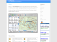
Graphical gpslog fixer
This is a tool to correct those "way of" points. You can delete points or move them around.
March 2007
TrailRunner
(via)TrailRunner is a route planning software for all kinds of long distance sports like running, biking, hiking, inline-skating, skiing and more. If you ever asked yourself how long your workout routes are and what route you should choose for this evening — then TrailRunner should be your training-partner.
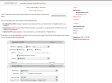
scriptaMac.at - GPS Automator Actions
A set of Automator Actions to download, upload and convert GPS routes, waypoints and tracks.
LoadMyTracks
by 1 other (via)LoadMyTracks is a piece of software that will communicate with GPS devices from many manufacturers to send and receive data. It can also be used to translate data between the popular GPX and KML (Google Earth) formats. The software provides support for Waypoints (single locations in space), Routes (lists of waypoints that can be used as instructions of where to go, Tracks (the breadcrumbs that many GPS devices keep to show where you have been) and additional data that may vary by device.
1
(7 marks)
