public marks

PUBLIC MARKS from nhoizey with tags géolocalisation & geo

May 2007

April 2007

geotagged - Nicolas Hoizey's Tagged Photos - Google Maps

Mes dernières photos sur Google Maps en 10 secondes grâces aux flux GeoRSS de Flickr !

gpicsync - Google Code

by 2 others
GPicSync automatically inserts location in your photos metadata so they can also be used with any 'geocode aware' application like Picasa/Google Earth, Flickr, loc.alize.us, etc.

geotagged - Nicolas Hoizey's Tagged Photos - Google Maps

Mes dernières photos sur Google Maps en 10 secondes grâces aux flux GeoRSS de Flickr !

March 2007

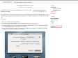
scriptaMac.at - Software

(via)
The GeoTagging Automator Action automatically tags your images with geographical coordinates and elevation data from a GPS track file. It supports a great range of image formats, including many raw image formats like Canon CR2, Nikon NEF and Adobe DNG.

February 2007

About at The geoURI scheme

The ‘geo’ Uniform Resorce Identifier (URI) aims to facilitate, support and standardize part of the interaction with geospatial services and applications. Accessing information about or trigger further services based on a particular place on earth shouldn’t be any harder than writing an email by clicking on a ‘mailto:’ link.

nhoizey's TAGS related to tag géolocalisation

4sq +   4square +   action +   adobe +   AGL3080 +   altitude +   AMOD +   api +   app +   apple +   automator +   canon +   carte +   cartographie +   cassandra +   cheat +   clarke +   clevermarks +   codepo8 +   conversion +   demo +   dev +   earth +   exemple +   exif +   fail +   finder +   Fire_Eagle +   flickr +   flux +   Foursquare +   fun +   g +   geo +   georss +   geosetter +   geotagging +   geoURI +   géo +   géocodage +   google +   google_earth +   Google_Maps +   gp:links +   gps +   GPX +   ietf +   image +   images +   interesting +   interestingness +   iphone +   iphoto +   javascript +   kml +   kmz +   latitude +   leopard +   librairie +   lieu +   lightroom +   location +   locr +   logger +   logiciel +   longitude +   mac +   map +   mappy +   maps +   Mapzen +   mashup +   MKL +   mobile +   myTracks +   opensource +   OpenStreetmap +   optimisation +   performance +   photo +   photography +   photos +   plugin +   POI +   recherche +   rencontre +   rendez-vous +   rer +   réseaux_sociaux +   rss +   service +   SimpleGeo +   tag +   tags +   train +   type:vidéo +   uri +   url +   web +   windows +