November 2007
Outline Maps
by 1 other (via)These maps may be printed and copied for personal or classroom use.To request permission for other purposes please contact the Rights and Permissions Department.
PDF format but may be opened in Photoshop Elements as an image for coloring and labeling.
April 2007
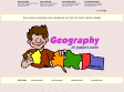
Free Geography PowerPoints
(via)Topics: What is geography?,What is Geography? (5th grade),Five Themes of Geography,Themes of Geography,Five Themes of Geography - Iceland,Themes of Geography,Continents and Oceans,Maps,Maps, Map Making,Maps (zip), Lines, Maps, and Globes,Understanding Types of Maps,Basic Geography Skills (Game),The Earth's BIG Features,What are landforms?,Landforms - What Goes Up Must Come Down,Landforms (beautiful pictures of various landforms), Landforms, continents (ppt, jeopardy),Physical Features (lesson) & Game,Geography (2nd grade),Geography Terms (6th grade),Communities Are In Different Places,What is a Community? (3rd grade),Communities (2nd grade), Communities - Now and Then, Here and There,
Geographies of Religion,PowerPoint Presentation Outline: Climate,Economic Geography,Cultural Geography, Architecture,Statues & Monuments,World Geography Questions,Regional Geography,Population,Physical Geography,Maps & Geographic Skills,Farming Techniques, Sub Saharan ,Sub-Saharan Africa,Australia,Geography of Australia (7th grade),Asia,East & South Asia,Russia & Central Asia ,Russia/Geography,Russia,North Africa (Rockingham),North Africa (Volstate),Europe (Rockingham), Europe (Volstate),The Geography of the United States, US States and Regions ppts,North America,South America, Latin America,Latin American Pictures,Latin America 3, Themes in World Geography (many ppts),World Regional Geography PowerPoints (lots)
March 2007
The 50 States
Very nice site with basic information on a variety of topics for each state (history, geography, famous people, state page links, symbols and more. Appropriate for upper elementary through middle school. NO ADS!!

Wayki: Show People Where!
by 4 othersQuick way for students to create map markers with photos and descriptions then share via a link. No signup required.
January 2007
Juicy Geography’s Google Earth page
Great site for using Google Earth in the Classroom
World66 - Your travel maps
by 1 otherMy World66 is a service where you can create a map of the places you have visited. Choose countries of the world, states, Candadian provinces, or European Countries. Generate the html to place in webpage or right click to copy or save image. Easy to use...no signup.
October 2006
Weekend Explorer - Series Description
Join the adventure as Emmy awarded host Jeffrey Lehmann takes you to incredibly scenic destinations throughout North America and the world in the award-winning Weekend Explorer television series. Each episode features a unique destination and searches out that area's best kept secrets as well as exploring traditional landmarks. Experience the new spirit of travel with the host, while learning about each destination through his informative and humorous narrative that includes culture, history, nature, and wildlife.
1
(9 marks)