2010

TuxMobil: Linux Applications for GPS Navigation & Geographic Maps
This is a survey of Linux applications (almost all of them are Free Software) for navigation with laptops, notebooks, handhelds, PDAs and mobile phones. They are useful for bikers, car drivers, ship and air plane navigators and others. Additionally there are map conversion tools and links to freely available maps for GPS devices.
2007

2006

2005
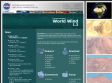
nasa world wind: open source alternative to google earth
lets you zoom from satellite altitude into any place on Earth. Leveraging Landsat satellite imagery and Shuttle Radar Topography Mission data, World Wind lets you experience Earth terrain in visually rich 3D, just as if you were really there.
web design programming blog software reference music tools css javascript art news linux google ajax blogs java webdesign howto search cool internet politics fun mac maps humor rss development photography toread technology flash tech tutorial games funny
web design programming blog software reference music tools css javascript art news linux google ajax blogs java webdesign howto search cool internet politics fun mac maps humor rss development photography toread technology flash tech tutorial games funny
1
(7 marks)


