March 2007
scriptaMac.at - Software
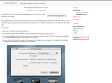
The GeoTagging Automator Action automatically tags your images with geographical coordinates and elevation data from a GPS track file. It supports a great range of image formats, including many raw image formats like Canon CR2, Nikon NEF and Adobe DNG.
February 2007
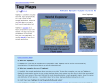
TagMaps
TagMaps is a toolkit to visualize text (well, tags) geographically on a map. Check out the sample applications, where we use Flickr tags on a map to build a world exploration tool.
October 2006
MapSack :: travel in the know
Super site de cartographie dynamique mixant le social networking, flickr, la folksonomie avec widget pour blog, génial quoi!!
1
(3 marks)
