02 May 2011
DC Street Tree Map › Interactive Maps & Tools › Geographic Resources | Casey Trees
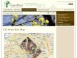
These data were collected by UFA (Urban Forestry Administration) as they planted and maintained street trees in Washington DC. The tree data as well as LiDAR elevational information were downloaded from DCGIS OCTO and then joined together to produce this dataset. The street tree data were last updated in September 2010, and the LiDAR in 2009.
06 April 2011

Natural Earth
Natural Earth is a public domain map dataset available at 1:10m, 1:50m, and 1:110 million scales. Featuring tightly integrated vector and raster data, with Natural Earth you can make a variety of visually pleasing, well-crafted maps with cartography or GIS software.
1
(2 marks)
